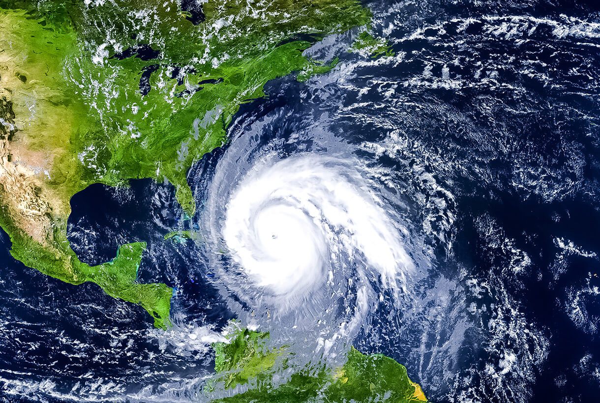
Hurricane Debby (now Tropical Storm Debby) could be the “wettest landfalling hurricane ever” according to forecasters, dropping over a foot of rain in Florida and South Carolina and 10 inches in Georgia as of this posting. Hurricane Debby first made landfall in Florida on Monday morning, and portions of the state’s western coast are seeing significant flooding and storm surge. In Fort Myers Beach, for example, the beach town saw an estimated 2 to 4 feet of storm surge on Sunday. Current forecasts show that Debby could dump an additional 3 to 9 inches of rainfall − and local amounts could range as high as 25 inches in South Carolina and 15 inches in North Carolina over the next several days.
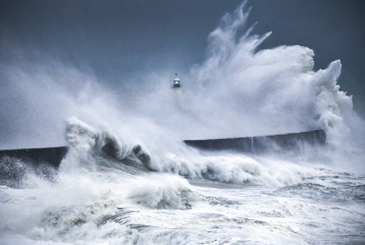
Storm surge is a byproduct of high winds and heavy rain. The National Oceanic and Atmospheric Administration (NOAA) defines it as “an abnormal rise of water generated by a storm, over and above the predicted astronomical tide.” It can cause just as much, if not more, damage than a hurricane itself.
And like all weather-related risks, storm surge can be difficult to predict. But there are resources available to help keep your people, places and property safe from this significant hazard. Were you aware the National Hurricane Center (NHC) provides an interactive tool to help predict storm surge? When utilized in conjunction with proactive critical event management (CEM), this mapping tool can significantly improve your organization’s preparedness.
The 411: Get the Full Storm Surge Picture
Storm surge directly causes approximately half of all deaths associated with massive storms, according to the NHC. Not only is every U.S. East and Gulf coast location vulnerable to storm surge, but storm surge is also powerful enough to move far inland. For example, during Hurricane Ike, coastal flooding from hurricane storm surge penetrated 30 miles inland, reaching areas as distant as southwestern Louisiana and southeastern Texas.
In another example, storm surge images and pictures showed flooding as high as 28 feet above normal tide levels during Hurricane Katrina. Surge waters resulted in enormous tragedy, contributing to this storm’s status as one of the most disastrous weather events in U.S. history. Other major hurricanes, such as Dennis, Isabel, Opal, Hugo and Camille, also had notable storm surges — and staggering death tolls to go along with them. Hurricane storm tides in Galveston in 1900 were responsible for the deaths of at least 8,000 people.
Take Your Hurricane Preparedness to the Next Level
Improve your hurricane preparedness with these resources from crisis management experts.
Predicting and Preparing for Storm Surge
One of the reasons the Galveston hurricane is on record as the deadliest weather disaster in United States history is because neither prediction models nor warning systems were as advanced then as they are today. But there’s still room for improvement when it comes to predicting, planning and preparing for storms and storm surge.
Enter the NHC’s Potential Storm Surge Flooding Map. For specific storms impacting both the East and Gulf coasts, this tool assesses and depicts the risk of coastal flooding from storm surge based on the National Weather Service’s (NWS) Sea, Lake and Overland Surges from Hurricanes (SLOSH) model. Users can manipulate the map to see how a specific geographic location may be impacted by storm surge and coastal flooding, as well as the potential height of water above ground.
Developed by a panel of experts for an audience including government agencies, the media and the general public, Potential Storm Surge Flooding Maps are released within 90 minutes of when the first hurricane watch or warning is issued.
The goal is to arm citizens, agencies and organizations with the information they need to make potentially life-saving decisions when a storm is bearing down.
Organizational Preparedness for Storm Surge
As hurricanes become more frequent and intense, risk and resilience professionals face growing challenges in protecting their people and operations. A strong approach to risk management, including investing in critical event management technology, helps organizations build resilience to mitigate impacts from hurricanes and resulting storm surge and flooding.
The right unified platform for critical event management offers advanced technological solutions with key capabilities that can help you answer questions such as:
- What’s happening and where?
- Real-time threat updates and alerts for better business continuity. AI-powered risk intelligence aggregates and filters complex data about incoming storms. Receive timely and accurate alerts about storm surge and flooding that could threaten your people and property so you can make fast, informed decisions and reduce response times.
- What can the past tell us?
- Data analytics for a 360-degree view of past, current and future hurricane and storm surge risk. Access to historical risk data and geographical analysis of past hurricanes and storm surge allows you to generate targeted reports for specific regions and timeframes. Identifying high-risk locations based on past events significantly improves planning and preparedness for the future.
- Who do we tell – and how?
- Multimodal, targeted communications to make sure everyone gets the message. Save lives and keep everyone in the loop with targeted, time-sensitive mass notifications. Pre-written templates, multi-language options and multiple communications channels, including phone, email and SMS, mean the right messages get to the right people at the right time.
- What is our plan?
- A responsive, easy-to-use interface ensures rapid response. Update and share information in real time as the situation changes. A mobile-first platform gives response teams the critical information they need to mobilize quickly, collaborate efficiently and adjust response strategies as the event unfolds.
- What’s happening and where?
Is your organization prepared for the next hurricane and the storm surge that may come with it? Get familiar with the Flooding Map and check out the Hurricane Preparedness Kit from OnSolve to make sure you’re ready when every minute counts.